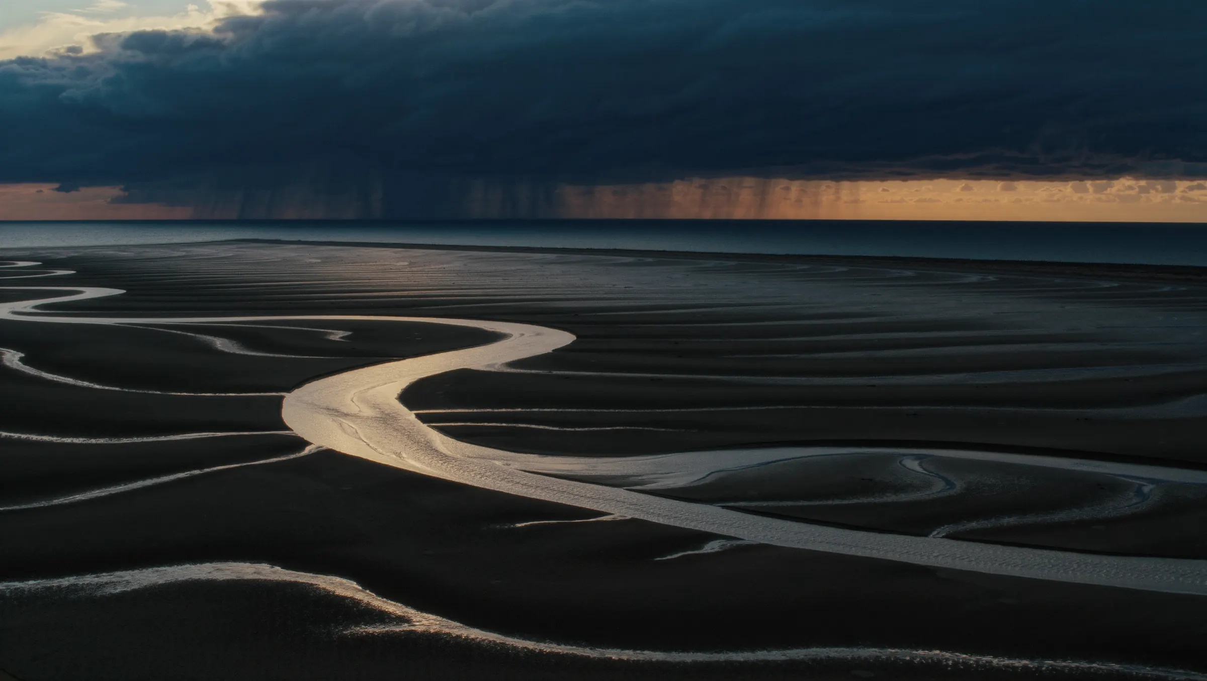
Whether a usable public access exists today is unknown.
Standing character
Standing class from the catalog type and the published name. Not a reading of today.
Size class
very large
Exposure
open
Water behavior
tidal
Flow dependency
unknown
Level sensitivity
unknown
Access evidence
Shore access: Unknown. Not named on this record. That is not a finding that it is absent.
Pier or platform: Unknown. Not named on this record. That is not a finding that it is absent.
Hand launch: Unknown. Not named on this record. That is not a finding that it is absent.
Hard-surface ramp: Unknown. Not named on this record. That is not a finding that it is absent.
Facilities
Restroom: Unknown. Not named. Missing is not the same as none.
Parking: Unknown. Not named. Missing is not the same as none.
Camping nearby: Unknown. Not named. Missing is not the same as none.
Fee, pass, or permit: Unknown. Not named. Missing is not the same as none.
Dock: Unknown. Not named. Missing is not the same as none.
Fish-cleaning station: Unknown. Not named. Missing is not the same as none.
Official accessibility wording: Unknown. Not named. Missing is not the same as none.
Accessibility not documented.
Standing hazards
Documented hazard families: tide. These are patterns on the record, not today's conditions.
Evidence source: https://wdfw.wa.gov/places-to-go/wildlife-areas/nemah-river-estuary-wildlife-area-unit. Checked 2026-09-04. What is not known today: wind, water level, and any notice posted after the source check.
Capacity and use pressure
Published notes: parking.
Seasonal and regulatory pressure
Section notes on the record: closure, regs.
Checked 2026-09-04. Review due 2026-11-06. That date is a target, not an appointment.
Same-day gate hours, fees and closures are set locally and are not mirrored here. Facility condition (surface, dock presence, ADA status) is not tracked at record level. Landowner boundaries adjacent to public corridors are outside this dataset.
Not applicable only where a signal is absent.
2026-11-06
Conditions & hazards
1 documented hazard family on record. These are standing characteristics of the water, not a forecast.
No live gauge height, discharge, tide table or wind reading is held in this record. Water clarity, temperature and hatch activity are not modelled and will not be estimated. Hazard families describe what the water is known to do, not what it is doing today.
Not applicable only where a signal is absent.
2026-11-06
Capacity & crowding
1 capacity pressure signal documented. Signals describe typical load, never live occupancy.
Live lot occupancy, ramp queue length and trailer counts are not observable from here. Event, tournament and regatta calendars are not ingested. Crowding language reflects documented patterns, not a prediction for your date.
Not applicable only where a signal is absent.
2026-11-06
Seasonal & regulatory pressure
2 regulatory pressure points. Rules here move with date, section and vessel.
Empty season windows mean no defensible dated harvest closure was published at the source used for this record — not that harvest is assumed open. The regulation booklet is authoritative; this layer flags where variance exists, it does not restate the rule. Emergency orders and in-season rule changes can post after the last source check. Species presence is context, never a catch expectation.
Not applicable only where a signal is absent.
2026-11-06
Field-check requirement
2 verifications must be completed on the day of travel before this water is considered go.
The link carries this water’s class, documented species and declared job in the URL fragment. No coordinates travel, and nothing is sent until you press it.
Empty windows mean the cited source published no defensible dated harvest closure — a completed check, not a gap. Harvest is not assumed open. Bag, size and gear still apply.
What's in this reading
Five layers on this water
Open a layer to see the documented signals behind it and the unknowns it cannot close. Every layer reports what an agency published — none of it is an observation of the water today.
What the record says
Nothing is recorded here for this water yet.
What this read cannot tell you
Same-day gate hours, fees and closures are set locally and are not mirrored here.
Facility condition (surface, dock presence, ADA status) is not tracked at record level.
Landowner boundaries adjacent to public corridors are outside this dataset.
Support is a hand-set weighting of how much documented material this layer rests on. It is not a probability and nothing here was measured.
Species layer
What this water is documented to hold
Tied to this named public water, not to a separate catalogue of fish. Presence is what the agency published. It is never a catch expectation, a hatch forecast or a lure list.
Where a reading would sit against the published bands
These are reviewed temperature bands for the species the agency documents here, each one carrying the source it came from. They describe the fish, not this water. Nothing on this page knows what Nemah River Estuary is doing today — put a thermometer in it and the drawing will show you where that number lands.
Detail
Stays on this device. It is not saved, not synced and not sent anywhere — this instrument has no account to attach it to.
None of the species named on this record carries a reviewed temperature band yet. That is a gap in the reference library, not a statement about this water.
Altitude matters more here than people expect. The same water at 9,000 feet holds about a quarter less oxygen at saturation than it would at sea level. Leave it blank for sea level.
Oxygen
What this water could hold, against what the standard asks
Enter a water temperature above and the ceiling for this water appears on the curve.
Saturation curve The most oxygen fresh water can dissolve at each temperature, corrected for the elevation entered. Physics, not biology: it falls as the water warms.
Your reading No water temperature entered yet. The same thermometer that answers the temperature question answers this one.
Which column applies Chosen from the fish this record documents — . A record naming both trout and warmwater species takes the coldwater column, because a criterion is a floor and the stricter floor is the one protecting what is there.
Saturation is the most this water could hold if it were in equilibrium with the air. Real water sits below it — respiration, decomposition and a weed bed at four in the morning all take oxygen out — so the curve is an upper bound on a good day, never a measurement. Only a meter in the water tells you what is actually there.
What this plate is telling you
Why the curve falls. Gas solubility drops as temperature rises. Water at 80°F cannot hold what the same water held at 50°F, whatever lives in it. That is why a summer warm spell and a fish kill turn up in the same week, and why the cold layer at the bottom of a stratified lake — perfect temperature, no resupply from the surface since spring — can be the emptiest water in it.
What this is not. Not a reading, not a forecast, and not a statement about Nemah River Estuary on any particular day. Agencies publish measured dissolved oxygen at many gauges — that number outranks everything on this drawing.
No band drawn for
Salmon — a family, not a species. The record has not said which one, and picking a member of it to fill the space would be inventing the answer.
Where else to look
Waters around this place
Rounded miles from the catalog’s coarse public location — about a hundred metres, enough for the basin. Nothing here is a pin of a fishing spot.
Tidal water. The read is about the stage of the tide and the structure it moves across.
Coastal water is a clock as much as a place. The same mark is three different marks across a tide, so before you pick the mark, work out the window: which stage you want, and what the water will be doing then.
Craft, not observation — this is the standing read for a marine. It holds no clarity, temperature, level, flow, tide or hatch for this water today, and it does not name a spot.
Detail
Water section
Tidal water. The read is about the stage of the tide and the structure it moves across.
A section through water of this class, near side on the left. It is craft, not a survey of Nemah River Estuary — the shape of this particular bank is yours to read when you get there.
1Channels, guts and drop-offs Fish use them to move on and off shallow ground with the tide and to ambush anything the falling water pulls off the flat. — likely.
2Jetties, piers, pilings and rock Structure in current creates a permanent eddy and a permanent food chain. It is the most consistent coastal feature there is, and usually the most accessible on foot. — likely.
3Rips and current lines The same seam logic as a river, on a much larger scale. Bait is held disoriented in the turbulence. — worth checking.
4Bottom transitions Different bottoms grow different food. The boundary carries both, and predators patrol it. — worth checking.
5Reading a surf beach Fish run the gutter and hold at the cuts, where the outgoing water concentrates food. — worth checking.
Not drawn: tide stage sets the terms. Those describe the whole system rather than a place in it, and putting them somewhere on this picture would be inventing a location to make it look fuller.
What this plate is telling you
Solid zones are features this class of water nearly always has. Dashed ones are the subtler reads — present often enough to look for, not often enough to assume.
Nothing here is an observation of today. No gauge reading, no clarity, no temperature and no fish went into this drawing. It is the same standing craft an angler carries between waters, and the water in front of you outranks all of it.
Plan view · where along the water
A stretch of coast, seen from above
Beach, bar, trough and a rip, with an estuary mouth at one end. The tide is the current here, and it rearranges the whole picture twice a day. It is a schematic of this class of water, not a survey of Nemah River Estuary — the shape of that particular shore is yours to read when you get there.
Nothing on this reach is doing anything unusual. That is a normal day, and normal days are read by walking rather than by diagram. Set a wind, a water state or a tide and the picture will move.
Tap the point the wind is coming from. The shore it is blowing onto is the one that collects the drift — and the one that is least pleasant to stand on.
Water state
Tide
Tap a marked zone on the picture, or choose one by name above, for what it is, why fish relate to it, and how to find it standing there with no map. Nothing here says a fish is present — it says the physical reason that piece of water is worth a cast, and under which conditions that reason gets stronger or stops applying.
Decision flow
Four questions before the first cast
The drawing names features. This is the order that keeps them from becoming a scavenger hunt. Start with the force moving the water, find the shape that interrupts it, ask what changed, then verify the part the diagram cannot know today.
Is the water level changing, or is the water moving?
Look for
Tide height separately from current direction and speed.
Why it matters
Those variables are related but not interchangeable. The same tide height can fish differently on a different current phase.
Where does moving water get squeezed?
Look for
Channel edge, inlet throat, bar cut, point, bridge or hard structure.
Why it matters
Constriction concentrates current. The edge of that current is usually easier to work than its center.
What disappears when the tide turns?
Look for
Exposed bar, flooded flat, dry cut, current seam changing direction.
Why it matters
Coastal structure is partly time-dependent. A useful feature can vanish without moving an inch on the chart.
When the water changes
It rained. They ran the dam. The wind swung.
Pick what actually happened. Nothing here reads a gauge — you supply the event, from your own eyes or the agency's page, and this says what it does to water of this class.
Still craft, not observation — this is what these changes do to a marine. It does not know whether any of them happened here, and it never will. The agency's page and your own eyes are the only things that do.
What this record changes about the read
Tide is documented on this record. Fix your window and your exit stage before you read anything else.
Cold-water species are documented here. Read for oxygen and temperature as much as for cover: broken water, inflows, shade and depth.
Current
Tide stage sets the terms
What it is
Coastal water is a current system on a clock. The stage of the tide decides depth, direction of flow, and whether a spot is fishable or strands you.
Why fish hold there
A lot of coastal marks give you an hour or two on one stage and go quiet either side of it. Which stage is the mark's own business — you learn it by turning up on the wrong one first.
How to find it
Plan the session around the stage, not the clock. Note the stage that cuts off your exit before you walk out on anything.
Depth
Channels, guts and drop-offs
What it is
The deeper cuts draining a flat, the trough between a surf bar and the beach, and the edge of any dredged or natural channel.
Why fish hold there
Fish use them to move on and off shallow ground with the tide and to ambush anything the falling water pulls off the flat.
How to find it
At low water, walk the ground and photograph it. What is invisible at high tide is obvious two hours before it.
Structure
Jetties, piers, pilings and rock
What it is
Built structure with published public access — breakwaters, fishing piers, bridge pilings, groynes — plus natural rock and reef.
Why fish hold there
Structure in current creates a permanent eddy and a permanent food chain. It is the most consistent coastal feature there is, and usually the most accessible on foot.
How to find it
Fish the up-current and down-current edges rather than the middle, and re-read them as the tide turns and the current reverses.
Current
Rips and current lines
What it is
Where flow accelerates around a point, through an inlet or over a bar, and where two bodies of moving water meet.
Why fish hold there
The same seam logic as a river, on a much larger scale. Bait is held disoriented in the turbulence.
How to find it
Look for standing waves, a line of colour or debris, and slicks. Fish the calm side of the line first.
Habitat
Bottom transitions
What it is
Sand to grass, mud to shell, sand to rock — the edge between two bottom types.
Why fish hold there
Different bottoms grow different food. The boundary carries both, and predators patrol it.
How to find it
On clear flats these read as hard colour changes from a high angle. Elsewhere you find them by feel through the line.
Structure
Reading a surf beach
What it is
Bar, gutter and cut: the sandbar offshore, the deeper trough inside it, and the gaps where water drains back out.
Why fish hold there
Fish run the gutter and hold at the cuts, where the outgoing water concentrates food.
How to find it
Wave shape gives it away — waves break on the bar, flatten over the gutter, and stay unbroken through a cut.
2 further cues for this water class are held at a higher detail setting.
Watch · verify · keep reading
Useful instruction outside this app
These links teach transferable mechanics. They are not sources for today’s access, rules, weather or safety. A video can explain what a current seam is; it cannot tell you whether the ramp at a named water is open this morning.
25 reviewed for this class of water. A dead link is a defect here, not a footnote, and the maintenance process re-checks these resources.
Agency and official references
Published by the bodies that measure and manage the water. These are the stable ones, and the ones to cite.
Official guide
Tides and Currents
NOAA National Ocean Service
Official explanation of the difference between vertical tide and horizontal current, how each is measured, and why coastline shape and wind matter.
What's the difference between a tide and a current?
NOAA National Ocean Service
A short official reset for one of the easiest coastal mistakes: water level moving up or down is not the same variable as water moving along the shore.
NOAA Center for Operational Oceanographic Products and Services
Predictions cover the astronomical tide only. Wind, rainfall, runoff and pressure are not in the model, and CO-OPS names places where wind routinely puts the real water level a foot or two off the table. This is why you check the observed level on a windy day, not just the prediction.
A structured beginner tutorial: what a chart is, how it differs from a map, compass roses, latitude and longitude, and where the depth data actually comes from. Work through this first, then keep Chart No. 1 open beside it.
U.S. Chart No. 1 — Chart Symbols, Abbreviations and Terms
NOAA Office of Coast Survey
The official dictionary of chart symbols, free as a PDF. It is the only way to know what the seabed notation, depth contours and fish-haven markings mean, and a shore angler reads exactly those.
How rips form from uneven wave breaking, and the visual cues — darker gaps between breaking zones, a choppy rippled surface, sand or foam moving offshore. It is safety information and structure reading at the same time, because those cues mark where the bottom deepens.
The three stages of cold water immersion, and the part most anglers have wrong: cold shock can be triggered by water as warm as 77°F, so a mild air temperature tells you nothing. Read it before spring wading and before any early-season boat or shore trip.
EPA's hub, including the route to current state, tribal and local advisories. Advisories are issued locally rather than federally, so this is how you find out whether one specific water is under one right now.
What a bloom looks like in the water — foam, scum, a spilled-paint surface — and the exposure routes for people and for dogs. The practical rule is to stay out of discoloured or foul-smelling water and check the local advisory first.
Clean, drain, dry as an actual procedure rather than a slogan: rinse the hull and gear, flush the motor, drain bilge and livewell before you leave the access, dry five days or towel down, bin unused bait. Written to be done every water, every time.
A good model of how a state regulations system is built: an annual pamphlet of statewide rules, water-specific exceptions that override them, and an emergency rule feed that supersedes the printed pamphlet mid-season. That three-part shape is near-universal, so it teaches you what to go looking for in your own state.
Georgia Department of Natural Resources, Law Enforcement Division
A numbered launch sequence done before joining the line: watch a launch or two to see how wind, current and the ramp's drop-off behave, then rig, pull tie-downs, check the plug and set bow and stern lines. It ends when the boat leaves the trailer, so retrieval needs another source.
Why it made the list: Re-verified 2026-09-26: page loads; the pre-line preparation steps, back-down and release steps, and a note on steep drop-offs at coastal ramps are present, with no retrieval section.
The retrieval half of the ramp: back in only until the boat floats, winch it on at slow speed instead of driving it on, and look for scour holes and sediment mounds at the ramp's end, which get worse at low water. It is written to protect the ramp and says little about etiquette.
Why it made the list: Re-verified 2026-09-26: page loads; explains how prop wash digs holes and builds a mound at the ramp end, and gives the check-the-ramp, winch-don't-race and float-don't-submerge steps.
Connecticut Department of Energy and Environmental Protection
The coastal version of the same gap: below mean high water the shore is held for public fishing and passage, but getting there from the upland is the adjoining owner's right, so a beach on a map is not a way in. This is Connecticut's rule; other states draw the public line in different places.
Why it made the list: Re-verified 2026-09-26: page loads; defines the public trust area as waterward of mean high water, lists public rights with case citations, and states only the littoral owner may reach the water from the upland.
NOAA JetStream (National Weather Service online school)
Wave size depends on wind strength, how long it has blown and fetch, the uninterrupted distance the wind crosses; a strong wind over a short fetch does not build big waves. The examples are open ocean, so the idea of fetch is the part that transfers to a long lake or a reservoir arm.
Why it made the list: Re-verified 2026-09-26: page loads (HTTP 200); the Wind Waves section defines strength, duration and fetch and describes whitecaps forming before a fully developed sea.
Defines the Small Craft Advisory and says there is no fixed definition of a small craft: any vessel the advisory's winds or waves would affect counts. Thresholds vary by region, the Great Lakes included, and the same page defines the Dense Fog Advisory as visibility of one nautical mile or less.
Why it made the list: Re-verified 2026-09-26: page loads; regional Small Craft Advisory thresholds (Great Lakes included), gale and storm definitions and a Reduced Visibility Hazards section with the Dense Fog Advisory are present.
National Park Service, Padre Island National Seashore
One coastal ramp page with every capacity input on it: busy early on weekends and holidays, 112 trailer spaces, no parking on park roads, overflow parking 4.3 miles away with no shuttle, and a ramp pass on top of the entrance fee. A template for what to look for on other ramps' pages, not a rule that applies elsewhere.
Why it made the list: Re-verified 2026-09-26: page loads; lists the space counts by vehicle type, the parking restrictions, the Malaquite Visitor Center overflow lot and the ramp pass.
Shows why a marine rule has to be resolved by position and date together: Florida state waters end at 3 nautical miles in the Atlantic and 9 in the Gulf, and scallop, snook and grouper seasons change by zone. Florida only, and a summary, so the current rule text still controls.
Why it made the list: Re-verified 2026-09-26: page loads; states the 3 nm / 9 nm limits and has zone maps with dated seasons for bay scallops, snook, hogfish and Atlantic grouper, including a transit rule through closed state waters.
Recreational Saltwater Fishing in the Greater Atlantic Region
NOAA Fisheries, Greater Atlantic Region
The federal layer from Maine to North Carolina: NOAA manages 3 to 200 nautical miles out, some species such as striped bass cannot be fished in federal waters at all, and a state's rules often apply to fish landed there wherever they were caught. It does not replace the state regulation for the port being used.
Why it made the list: Re-verified 2026-09-26: page loads; states the 3–200 nm federal jurisdiction, lists species prohibited in federal waters, notes that state rules often apply to fish landed regardless of catch location, and covers the federal permit requirement.
What to do once fog is on the water: slow down, run lights in daylight, listen for engines and buoy signals, and hold position somewhere safe if bearings are lost. It is written with open water and shipping lanes in mind, and lists GPS as a way to fix position, which is not the same as seeing traffic or the landing.
Why it made the list: Re-verified 2026-09-26: page loads; the under-one-mile dense fog definition and the slow-down, lights, listen, radar, GPS/chart, stay-put, sound-signal, compass and avoid-shipping-lanes steps are present.
USCG Amalgamated Navigation Rules — International & U.S. Inland
U.S. Coast Guard Navigation Center
The controlling text, on inland waters as well as at sea: Rule 5 requires a look-out by sight and hearing, Rule 7 warns against assumptions from scanty radar information, and Rule 19 requires a safe speed for restricted visibility. It is legal text, not a tutorial, and small lakes outside federal navigable waters fall under state boating law instead.
Why it made the list: Re-verified 2026-09-26: page loads; Rules 5, 6, 7(c), 19 and 35 are present, with the Inland differences marked.
Written by nonprofits and watershed groups rather than an agency. Useful teaching, and labelled so it is not mistaken for an agency’s word.
Independent guide
Weather for Boating
BoatUS Foundation
Adds the small-boat detail the agency pages skip: a long, shallow fetch such as Lake Erie builds short, steep chop, waves running against a current stand up, and a forecast still needs checking against the horizon once out. It is a general boating study guide, so it says little about paddle craft or the landing shore.
Why it made the list: Re-verified 2026-09-26: page loads after redirect from boatus.org/study-guide/planning/weather; sections on wind and current effects, fetch and whitecaps, shallow-water chop, scanning the horizon and taking gusts on the bow are present. A nonprofit source, used because no agency page found explains fetch for inland small craft.
Craft, taught by people who fish. Chosen for the instruction and the publisher’s track record, not because a recommendation algorithm surfaced them — the observed audience numbers are on each card so you can weigh that yourself.
Video
Using NOAA Tides and Currents Online
David Burch, Starpath School of Navigation
A practical walkthrough of the NOAA interface. Use it to learn the tool, then use NOAA itself as the authority for the actual observation or prediction.
Why it made the list: 3,888 views and 37 likes observed 2026-09-08 — by far the smallest audience in this library. It is here on the author's track record as a navigation-school director, not on reach.
How to Read the Beach for Surf Fishing [Beginner Tutorial]
Benjie Kim Fishing
Identifying troughs, cuts, sandbars and structure from the sand, including walking the same stretch at low tide to see the bottom you will be fishing on the flood. No agency publishes shore-reading instruction for anglers, so this fills a real gap.
Why it made the list: 578,142 views and roughly 10,000 likes observed 2026-09-08; channel has 46.1K subscribers and a sustained back catalogue of surf-fishing instruction. The beaches shown are Southern California — the technique transfers, the locations do not.
Kayak Touring | How to Deal with Wind While Paddling
PaddleTV (Ken Whiting), with the American Canoe Association
A three-minute lesson on handling a touring kayak in wind, from an instructional series made with the American Canoe Association. It is about handling the boat, so it belongs after the fetch and landing-shore check, not in place of it.
Why it made the list: oEmbed confirmed 2026-09-26 (title and PaddleTV author returned); 3:14, published 2017-08-25, ACA partnership credited. Judged from the listing and description; the transcript was not retrievable. The description carries gear links.
You have answered where and what kind of water. Each instrument below answers the next question in the same workflow, and each link carries this record's water class, documented species, standing read, access position and declared job with it. Nothing is posted automatically, and no coordinates or private water travel in the handoff.
This packet carries
Water
Nemah River Estuary
Class
marine
Job
Not declared
Species
Not named
Water temperature
Not measured
01WaterYou are here
Field Sense Navigator — which water, what kind, what to look for and what still has to be checked today.